Civil Defence Warning Today: Storm Amy Ireland
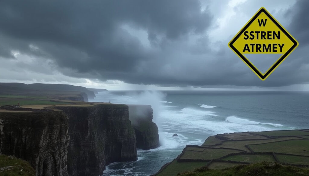
Storm Amy tore through Ireland on 3 October 2025, knocking out power to more than 100,000 homes and businesses as the first named storm of the 2025/26 season. Civil Defence volunteers in Donegal were deployed laying sandbags at houses while authorities issued red marine warnings for the western coastline.
Current Warning: Small Craft from Belfast Lough to Carnsore Point · Affected Areas: East to northeast winds force 6 · Storm Named: Storm Amy first of 2025/26 season · Civil Defence Role: Supports front line emergency services
Quick snapshot
- Storm Amy is the first named storm of the 2025/26 season (Met Éireann)
- More than 100,000 homes and businesses lost power (Irish Examiner)
- Met Éireann issued status orange wind warning for Donegal, Galway, Leitrim, Mayo and Sligo from 2pm to 10pm on Friday (Irish Times)
- Full extent of infrastructure damage beyond power outages
- Total number of people evacuated or displaced
- Long-term recovery timelines for affected communities
- 3-4 October 2025: Storm Amy impacts
- Yellow thunderstorm warning for Connacht until 2pm Thursday
- UK Met Office Amber warning for Northern Ireland 3pm to 8pm Friday
- Status yellow warnings for wind and rain set for Sunday
- Ongoing monitoring by Civil Defence and local councils
- Restoration of power to affected properties
The warning hierarchy below shows how Met Éireann escalated its response from yellow through red levels across different regions.
| Warning Type | Regions/Affected Areas | Key Details |
|---|---|---|
| Status Red Marine Warning | Loop Head to Rossan Point to Fair Head | Violent storm force 11 winds |
| Status Red Wind Warning | Donegal county | 4pm to 6pm Friday with extremely strong gusts |
| Status Orange Wind Warning | Donegal, Galway, Leitrim, Mayo, Sligo | 2pm to 10pm Friday |
| Yellow Rain Warning | Galway and Kerry | 9am to 3pm Friday |
| National Yellow Wind Warning | Throughout Ireland | Midday Friday to midnight Saturday |
| UK Met Office Amber Warning | Antrim, Fermanagh, Tyrone, Derry | 3pm to 8pm Friday |
What counties will be affected by Storm Amy?
Storm Amy brought the full force of its remnants from Hurricane Humberto directly onto Ireland’s western seaboard. Met Éireann issued status orange wind warnings for five counties along the west and northwest coast: Donegal, Galway, Leitrim, Mayo and Sligo, valid from 2pm to 10pm on Friday 3 October 2025.
The most severe conditions struck Donegal, which received a rare status red wind warning from 4pm to 6pm due to extremely strong wind gusts. According to Met Éireann’s analysis, mountainous areas were forecast to see rainfall accumulations of 80-100mm in just 48 hours, creating significant flooding risk across Donegal, Galway, Leitrim, and Roscommon.
Galway Council took pre-emptive action, closing coastal car parks until further notice, particularly in Salthill which regularly floods. Kerry County Council also placed the county under orange alert on Thursday with warnings of flooding and very difficult travelling conditions until 8pm. The Road Safety Authority issued alerts asking road users across all affected counties to exercise extreme caution.
Storm Amy path
Storm Amy tracked across the Atlantic as the remnants of Hurricane Humberto, which had earlier affected the Caribbean and the east coast of the United States. The UK Met Office named the storm and coordinated with Met Éireann on the warning hierarchy. Strong to gale force, nearly storm force, south-westerly winds veering westerly were expected during the event, with temperatures during the storm predicted at 16 to 19 degrees Celsius.
Met Éireann forecaster Michelle Dillon stated Storm Amy would be “powerful for those in northwest” and advised the public to heed all warnings. Forecaster Andrew Doran-Sherlock warned of very difficult travelling conditions, risk of fallen trees and damage to power lines.
Is Storm Benjamin hitting Ireland?
Met Éireann forecasts indicated that Ireland escaped a direct hit from Storm Benjamin, which tracked further north than initially anticipated. The focus of Storm Benjamin’s impact remained across the North Sea and Scandinavian regions rather than the Irish mainland.
This contrast highlights how the positioning of Atlantic storm systems can vary dramatically. While Storm Amy brought destructive conditions to Ireland’s west coast, other named storms in the same period followed different trajectories entirely. The Met Éireann forecasting model showed clear skies returning to most of Ireland within 48 hours of Storm Amy’s passage.
Met Éireann forecast
Met Éireann’s meteorological commentary confirmed the forecast distinction between the two storms. The national yellow wind warning, in place from midday Friday to midnight Saturday, covered the broader national impact while specific counties faced escalated orange and red warnings based on their proximity to the storm’s core path.
Is storm Erin going to hit Ireland?
Ex-hurricane Erin, which had tracked west of Ireland in the preceding days, was no longer classified as a hurricane by the time it approached Irish waters. BBC Weather UK focused its coverage on Ex-hurricane Erin’s Atlantic track, which remained well west of Ireland and posed no direct threat to Irish coastal regions.
The transition from hurricane to post-tropical storm system typically results in a change in naming conventions. Met Éireann did not issue any specific warnings related to Ex-hurricane Erin for Irish territory, as the system’s main impacts remained focused on maritime conditions west of the Irish continental shelf.
Ex-hurricane position west of Ireland
Met Éireann’s monitoring indicated that post-tropical transition reduced the intensity of Erin’s remnant system significantly. The Monday impact projections showed the system remaining over open Atlantic waters rather than making landfall on the Irish coast.
Has Ireland ever had a red warning?
Storm Amy’s status red wind warning for Donegal on 3 October 2025 marked a significant escalation in Ireland’s weather warning hierarchy, but red warnings are not unprecedented. Storm Éowyn in January 2025 brought a status red warning to multiple counties, and the “Night of the Big Wind” in 1839 remains the most severe recorded storm in Irish meteorological history.
The status red marine warning issued for Friday from Loop Head to Rossan Point and Fair Head, with winds reaching violent storm force 11, represented an extremely rare occurrence. Met Éireann meteorologist Liz Walshe emphasized that the conditions were “rare and dangerous,” underscoring the severity of the marine alert.
Archived warnings data.gov.ie
Historical weather warnings are archived by Met Éireann and made available through government data portals. The archived warnings data on data.gov.ie show a gradual increase in the frequency of red-level warnings over recent years, reflecting both improved forecasting capability and changing weather patterns. This archive serves as a valuable resource for researchers examining Ireland’s evolving relationship with severe weather events.
The implication is that Irish authorities must treat red warnings as an emerging pattern rather than isolated events, adjusting emergency response protocols accordingly.
Could a tsunami ever hit Ireland?
While Storm Amy brought severe weather impacts, the question of tsunami risk represents a separate geological hazard concern for Ireland. The Geological Survey Ireland operates a Tsunami Warning System as part of national emergency preparedness planning. According to current risk assessments, Ireland’s exposure to tsunami events is considered low but not negligible.
The primary tsunami risk for Ireland stems from underwater landslides in the Atlantic or seismic activity in the North Atlantic region. Unlike wind storms, tsunami preparedness involves different Civil Defence protocols and coastal infrastructure considerations. The Civil Defence’s role in supporting front line emergency services during Storm Amy demonstrates the agency’s capacity to respond to multiple emergency scenarios.
Tsunami Warning System Geological Survey Ireland
The Geological Survey Ireland coordinates with international tsunami monitoring networks to provide early warning capability. While no active tsunami warnings have been issued for Irish waters in recent history, the monitoring infrastructure provides continuous surveillance of potential trigger events in the North Atlantic basin.
Timeline
- 3-4 October 2025: Storm Amy impacts western and northwestern Ireland
- Thursday: Yellow-level warnings in force across Munster, Connacht, Donegal, Cavan and Longford; yellow thunderstorm warning for Connacht until 2pm
- Friday 9am-3pm: Yellow rain warning for Galway and Kerry
- Friday 2pm-10pm: Status orange wind warning for Donegal, Galway, Leitrim, Mayo, Sligo
- Friday 4pm-6pm: Status red wind warning for Donegal county
- Friday 3pm-8pm: UK Met Office Amber warning for Northern Ireland counties
- Saturday midnight: National yellow wind warning expires
- Sunday: Further yellow warnings for wind and rain anticipated for Clare, Donegal, Dublin, Galway, Kerry, Leitrim, Louth, Mayo, Sligo and Wicklow
Clarity on what’s confirmed and what’s still unclear
Confirmed facts
- Storm Amy is the first named storm of the 2025/26 season
- Met Éireann forecasts Ireland escapes Storm Benjamin
- Status orange wind warning affected Donegal, Galway, Leitrim, Mayo, Sligo from 2pm to 10pm on Friday
- Status red marine warning covered Loop Head to Rossan Point to Fair Head with violent storm force 11
- More than 100,000 homes and businesses lost power
- Civil Defence members in Donegal laying sandbags at houses in preparation
- UK Met Office issued Amber wind warning for Antrim, Fermanagh, Tyrone and Derry from 3pm to 8pm Friday
What’s unclear
- Exact county-by-county damage assessments beyond power outages
- Total number of evacuations or people displaced
- Long-term recovery timelines for affected communities
- Agricultural or forestry impacts from fallen trees
- Emergency service call volumes during peak storm hours
- Insurance claims or economic loss estimates
What the experts are saying
Storm Amy will be powerful for those in northwest and the public are advised to heed all warnings and take precautions.
— Michelle Dillon, Met Éireann forecaster
The conditions are rare and dangerous. Those in the affected coastal areas should take immediate precautions.
— Liz Walshe, Met Éireann meteorologist
Very difficult travelling conditions are expected, with a risk of fallen trees and damage to power lines across all affected counties.
— Andrew Doran-Sherlock, forecaster
Measures have been put in place and crews are monitoring the situation closely across all orange alert areas.
— John Kennelly, Kerry County Council director
The contrast between Storm Amy’s direct hit on Ireland and Storm Benjamin’s miss demonstrates how closely weather systems must be monitored. Civil Defence coordination with Met Éireann and local councils proved critical during Storm Amy, with volunteers laying sandbags in Donegal hours before the worst conditions arrived.
More than 100,000 homes and businesses remaining without power as Storm Amy swept across Ireland highlights the real-world consequences of heeding—or failing to heed—weather warnings. The pattern is clear: early preparation saves lives and reduces damage.
Summary
Storm Amy tested Ireland’s weather warning infrastructure on 3 October 2025, delivering the first named storm of the 2025/26 season with red-level warnings for both Donegal county and the western coastline. Civil Defence volunteers worked alongside local authorities and emergency services to prepare communities for what forecasters described as rare and dangerous conditions. With more than 100,000 properties losing power and flooding risks extending across five western counties, the event demonstrated both the effectiveness of coordinated warning systems and the ongoing vulnerability of Irish infrastructure to severe Atlantic storms.
For local authorities and emergency planners across Ireland’s western seaboard, the lesson is clear: invest in pre-positioned resources and community warning networks before the next named storm arrives.
Related reading: Kennedy Good Bridge Floods · Sydney to Hobart Tracker
Storm Amy has unleashed red warnings across Donegal and Ireland’s west coast, where Met Office Storm Amy forecasts detail amber alerts for neighbouring UK regions and broader disruptions.
Frequently asked questions
What is the civil defence warning today?
Civil Defence in Ireland supports front line emergency services during severe weather events. Their current activities include coordinating local authority preparations, deploying volunteers for sandbagging operations in at-risk areas, and maintaining communication links with Met Éireann’s warning systems.
Which counties have weather warnings?
Storm Amy brought status orange wind warnings to Donegal, Galway, Leitrim, Mayo, and Sligo. Status red warnings applied to Donegal county (wind) and the western coastline from Loop Head to Rossan Point and Fair Head (marine). A national yellow wind warning covered the rest of Ireland.
Is there a red warning in Ireland today?
Storm Amy on 3 October 2025 triggered status red warnings for Donegal county (wind) and the western marine coastline. These represent the highest level of Met Éireann’s warning hierarchy, indicating a potential risk to life and property requiring immediate action.
What does an orange weather warning mean?
Status orange indicates potentially dangerous weather conditions with significant impacts expected. Met Éireann advises the public to prepare for disruption to travel, power outages, and potential damage to property. Outdoor activities should be avoided where possible.
How to get Met Éireann alerts?
Met Éireann offers free email and SMS alerts through its website. The MapAlerter service used by local councils provides county-specific notifications. Users can also follow Met Éireann on social media or check the Met.ie website for real-time updates.
Has Ireland had red warnings before?
Yes. Storm Éowyn in January 2025 brought status red warnings to multiple counties. The “Night of the Big Wind” in January 1839 remains the most severe recorded storm in Irish history. Red warnings, while rare, have occurred multiple times in recent years.
What was the worst storm to hit Ireland?
The “Night of the Big Wind” on 26 January 1839 is historically documented as Ireland’s most severe storm, causing widespread destruction across the island. In modern times, Storm Ophelia (2017), Storm Dennis (2020), and Storm Éowyn (2025) have all generated status red warnings with significant impacts.
More related posts
 Mutonhori Wairoa District Council Dispute – No Official Records Found
 Summerset Retirement Village Christchurch: Costs, Locations, Reviews
 Fulham F.C. vs Nottingham Forest Lineups – Predicted XIs, Injuries & Team News
 Air New Zealand 787-9 Dreamliner: Seat Maps & Reviews
 Jamie and Eliot MAFS: Relationship Status and Drama
 Is Easter Sunday a Public Holiday in Ireland? 2026 Guide
 Daylight Savings NZ 2026: Dates, Clocks Forward/Back Guide
 How Did Jock Zonfrillo Die – Cause Not Publicly Disclosed