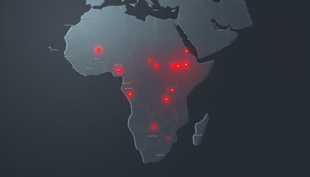
Map of African Countries: Political Map with Capitals
A good political map of Africa does more than label borders—it tells the story of 54 distinct nations across one of the world’s most dynamic continents. This guide pulls together the best free resources, from labeled capital maps to printable PDFs, so you can stop guessing and start exploring.
Number of countries: 54 · Largest country: Algeria (2.38 million km²) · Most populous nation: Nigeria · Continent area: 30.37 million km²
Quick snapshot
- Africa has 54 UN-recognized countries (GIS Geography)
- South Africa operates three separate capitals (GIS Geography)
- Free PDF maps available from academic and government sources (GIS Geography)
- Western Sahara’s status varies by source
- Some lists count 54 nations, others 56
- Exact publication dates missing from several map sources
- University of Texas reference maps (academic-grade PDFs)
- GIS Geography political maps with labeled capitals
- MapChart custom map generator
- Northern Africa: Cairo, Algiers, Rabat
- Southern Africa: Pretoria, Cape Town, Bloemfontein
- Over 1,000 islands dot the continent’s coastline
Africa’s political geography spans a continent of striking contrasts—54 nations, multiple capitals per country in some cases, and over 1,000 islands along its coastline. The table below consolidates verified facts about Africa’s scale and political structure.
| Fact | Detail |
|---|---|
| Continent area | 30.37 million km² |
| Number of countries | 54 |
| Approximate population | 1.4 billion |
| Largest country | Algeria (2.38 million km²) |
| Smallest country | Seychelles |
| Most populous nation | Nigeria |
| Number of islands | Over 1,000 |
Map of African Countries and Their Capitals
Five regions span the continent, each home to distinct nations and their administrative centers. The political map labels every country along with its capital city, making it essential for students, researchers, and anyone planning travel or business across Africa.
Northern Africa
The northern rim includes Egypt (Cairo), Algeria (Algiers), Morocco (Rabat), Tunisia (Tunis), Libya (Tripoli), and Sudan (Khartoum). Maps from the University of Texas Libraries mark these nations clearly alongside major cities and geographical features. University of Texas Libraries provides an academic-grade PDF reference that labels each country precisely.
Western Africa
Nigeria stands as the continent’s most populous nation, with its capital Abuja marked on every accurate political map. Angola’s capital Luanda, Ghana’s Accra, and Senegal’s Dakar appear on standard maps from Nations Online Project. Nations Online offers detailed political maps emphasizing international borders alongside capital cities.
Eastern Africa
Kenya (Nairobi), Tanzania (Dodoma), Ethiopia (Addis Ababa), and Zimbabwe (Harare) anchor the eastern region. The GIS Geography site lists all 54 countries with their capitals, drawing on United Nations data to ensure accuracy. GIS Geography allows free download of their labeled political map for educational use.
Southern Africa
South Africa presents a unique case on any political map: the nation operates three separate capitals—Pretoria for the administrative branch, Cape Town for the legislative branch, and Bloemfontein for the judiciary. Clinton White House Archives documents this unusual arrangement, which often surprises those first encountering the country’s governance structure.
Central Africa
The central region encompasses nations like the Democratic Republic of the Congo (Kinshasa), Cameroon (Yaoundé), and the Republic of the Congo (Brazzaville). Benin’s capital presents another cartographic quirk: Porto-Novo serves as the constitutional capital, while Cotonou hosts the government seat. Scribd hosts comprehensive lists verifying these capitals across multiple sources.
Students who rely on outdated maps risk memorizing incorrect capitals—and that mistake costs marks on geography quizzes and credibility in business negotiations.
World Map of Africa
A world map showing Africa puts the continent in global context—its 30.37 million km² position between the Atlantic and Indian Oceans makes it a nexus for trade, culture, and geopolitics. These maps range from minimalist outline versions to detailed political boundary editions.
Political boundaries
Political maps emphasize borders between nations, with each country shaded differently for clarity. Nations Online Project provides a political map with all nations, borders, national capitals, and major cities marked simultaneously. Nations Online constructs these maps to highlight international boundaries rather than physical terrain.
Physical features
Physical maps of Africa showcase the Sahara Desert dominating the north, the Congo Basin rainforest at the center, and the Great Rift Valley cutting through the east. While the continent’s political boundaries get most of the educational attention, physical maps reveal why certain regions support different populations and economies.
Satellite view
Satellite imagery transforms the flat political map into a tangible landscape—you can see the green Congo Basin forest contrasting against brown Saharan sands, or the snow-capped peaks of Mount Kilimanjaro. Google Maps provides free satellite access, though the lack of country labels means you’ll need to toggle between satellite and map views for full utility.
Map of African Countries PDF
PDF maps offer advantages over web embeds: they print crisply, work offline, and can be annotated with markers or handwritten notes. The best free options come from university archives and established cartographic websites.
Free downloadable PDFs
Several sources provide free PDF political maps of Africa with countries and capitals labeled clearly. The University of Texas Libraries offers an academic reference map that includes countries like Nigeria, São Tomé and Príncipe, and Gabon with precise labeling. UT Maps provides one of the most reliable Tier 1 sources for educational cartography.
FreeWorldMaps.net delivers printable PDFs in A4 size using the Lambert Azimuthal Projection, ensuring accurate landmass proportions. FreeWorldMaps also includes outline and coloring-page versions ideal for classroom activities.
High-resolution options
Paintmaps.com offers vector-based Africa maps in PDF, SVG, and EPS formats with colored countries and free printing rights. Paintmaps allows free download and modification for graphic and educational projects, making it valuable for presentations or classroom materials.
Labeled versus blank
Choosing between labeled and blank maps depends on your purpose. Students benefit from labeled versions that reinforce country-capital associations, while teachers and quiz creators often prefer blank outlines where learners fill in names themselves. Wattsburg.org provides blank PDF maps with instructions for drawing lines to countries too small for label placement.
Educators who need academic credibility should prioritize university sources like UT Maps, while those planning classroom activities should opt for the durability and ease of use offered by sites like FreeWorldMaps.
Google Map of Africa
Google Maps provides the most accessible interactive option, combining real-time navigation with satellite imagery across any zoom level. While not optimized specifically as a political map, it offers useful tools for exploring Africa’s geography.
Interactive features
Google Maps allows panning and zooming across the entire continent without downloads or browser plugins. You can search for specific countries by name, and the map displays current international boundaries. Nations Online also offers an embed option alongside their downloadable versions for web-based use.
Zoom levels
Zooming out shows Africa’s position between Europe and Asia, with the Mediterranean Sea separating it from Europe to the north. Zooming in reveals individual neighborhoods in capitals like Nairobi, Lagos, or Cairo. However, Google Maps doesn’t label country borders by default—you’ll need to toggle layers or cross-reference with a political map to see where one nation ends and another begins.
Street View availability
Street View coverage varies dramatically across Africa. Major tourist destinations and large cities have extensive street-level imagery, while rural areas and smaller nations often lack any coverage. Urban centers in South Africa, Egypt, Morocco, Kenya, and Nigeria generally have good coverage, but expect gaps in landlocked nations and remote regions.
Professionals who need clearly marked political boundaries for educational materials or presentations will find Google Maps insufficient without supplementation from a labeled academic source like the University of Texas Libraries PDF.
Simple Africa Map
Simple Africa maps strip away complexity to focus on outlines and relative positions. These work best for coloring activities, quick reference, and situations where you need recognizable shapes without detailed labeling.
Outline maps
Outline maps show only country borders without names, capitals, or geographic features. FreeWorldMaps includes blank outline versions alongside their labeled political maps, giving teachers flexibility for testing exercises. Students can color regions by category—coastal versus landlocked, for instance.
Black and white versions
Alabama Maps provides black-and-white versions of their Africa capitals maps in both PDF and JPEG formats. Alabama Maps serves educators needing photocopy-friendly materials without color printing costs.
Customizable tools
MapChart.net enables custom editing and coloring of Africa maps for free download. MapChart allows users to highlight specific regions, create custom color schemes, and generate maps tailored to specific lesson plans or presentations without advanced design software.
Teachers who want students to develop active recall rather than passive recognition should choose blank outline maps over labeled versions, even though the cognitive load shifts entirely to the learner.
Confirmed facts
- Africa has 54 UN-recognized countries (verified across GIS Geography, UN data, and multiple academic sources)
- South Africa operates three capitals: Pretoria (administrative), Cape Town (legislative), Bloemfontein (judicial)
- Free PDF political maps available from Tier 1 university sources (UT Maps, Alabama Maps)
- Nigeria’s capital is Abuja, confirmed across multiple source types
- Benin’s constitutional capital is Porto-Novo, though Cotonou hosts the government seat
What’s unclear
- Western Sahara’s status varies by source—some include it as separate, others as part of Morocco
- Some sources list 54 countries, others 56, due to disputed territory inclusion
- Several map sources lack explicit publication dates, complicating verification
Quotes and Expert Perspectives
“According to the United Nations, Africa has 54 countries.”
— GIS Geography (Mapping Resource)
“South Africa has three branches of government and a capital city for each.”
“You can download and change vector maps in EPS, SVG, Adobe Illustrator and PDF format and use them freely.”
Summary
A quality political map of Africa rewards careful sourcing. University archives like the University of Texas Libraries and Alabama Maps deliver Tier 1 accuracy without cost, while established cartographic sites like Nations Online and GIS Geography offer convenience alongside reliability. For geography students, the implication is clear: cross-reference any map against UN-verified country counts, or risk learning outdated borders. For educators, free PDFs from academic sources outperform commercial alternatives in credibility without sacrificing print quality.
Frequently asked questions
How many countries are in Africa?
The United Nations recognizes 54 countries on the African continent. Some sources list 56 when including disputed territories like Western Sahara, but UN membership standards establish the count at 54.
What is the capital of South Africa?
South Africa uniquely operates three capitals: Pretoria serves as the administrative capital where the government executes policy, Cape Town hosts the legislative parliament, and Bloemfontein houses the judiciary. This arrangement reflects the country’s federal structure established post-apartheid.
Which African country is largest by land area?
Algeria spans 2.38 million km², making it the largest country in Africa by area. It borders the Mediterranean Sea to the north and extends deep into the Sahara Desert.
Where can I download a blank Africa map?
FreeWorldMaps.net offers blank outline and coloring versions alongside their labeled political maps. Wattsburg.org also provides blank PDFs with instructions for hand-labeling, ideal for classroom exercises. University sources like Alabama Maps provide additional options in black and white formats.
What oceans border Africa?
Africa borders the Mediterranean Sea to the north, the Red Sea to the northeast (separated by the Sinai Peninsula), the Indian Ocean to the southeast, and the Atlantic Ocean along the western coast. This maritime positioning gives the continent strategic trade importance.
How to label countries on an Africa map?
Download a labeled political map from a verified source like GIS Geography or UT Maps as a reference. Print a blank outline map and practice by filling in country names from memory, then check against your reference. MapChart.net allows creating custom labeled versions for practice or teaching materials.
What is the equator’s path through Africa?
The equator passes through seven African nations: São Tomé and Príncipe, Gabon, the Republic of the Congo, the Democratic Republic of the Congo, Uganda, Kenya, and Somalia. It divides the continent into northern and southern hemispheres and influences climate patterns in each region it crosses.
Related reading: country capitals
This political map pairs well with labeled printable maps highlighting boundaries and facts across Africa’s 54 sovereign nations.
More related posts
 How Many States in Australia? 6 States, Territories Explained
 Healthy Harvest Fruit and Veges: Christchurch Guide
 Matariki Stars and Their Meanings – The 9 Stars Explained
 Dyson Fan and Heater – Bladeless Models Review
 How to Play Solitaire: Step-by-Step Rules & Setup
 How to Remove Odors from Fridge: Fast & Effective Methods
 Best Small Business Invoice Software: Top Picks for Ireland
 J. Cole Concert Tickets 2026: Fall-Off Tour Details