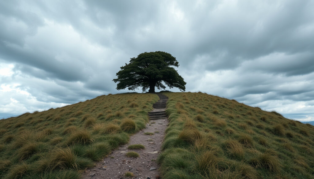
One Tree Hill New Zealand: History, Walk & Controversy
There’s a spot in Auckland where the city skyline meets a story of protest, volcanic fire, and a single missing tree. Maungakiekie / One Tree Hill isn’t just a lookout — it’s a landscape carved by centuries of Māori occupation, colonial land grabs, and a chainsaw attack that made headlines worldwide.
Elevation: 182 m (597 ft) ·
Crater count: 3 ·
Largest volcanic cone in Auckland by area: after Rangitoto ·
Māori name: Maungakiekie ·
Suburb: One Tree Hill, Auckland ·
Walk time to summit: approx 30–45 minutes (one way)
Quick snapshot
- Volcanic cone 182 m high with 3 craters (NZ History (government history site))
- Second-largest volcano in Auckland by area (NZ History)
- Largest pre-European pā on the isthmus (NZ History)
- Exact date and person who felled the original tōtara in the 19th century (Journeying Jeff (travel blog))
- Whether a new tree will ever be replanted on the summit (Journeying Jeff (travel blog))
- ~67,000 years ago: volcano erupted (Cornwall Park Trust (park authority))
- 1852: original tōtara removed by settler (Journeying Jeff)
- 2000: pine tree chainsawed and removed (Journeying Jeff)
- Ongoing discussions about summit landscaping (Tūpuna Maunga Authority (Māori co-governance body))
- Public reserve open 24 hours with sealed walking tracks (Tūpuna Maunga Authority (Māori co-governance body))
Six key specs define Maungakiekie / One Tree Hill as a natural and cultural landmark — from its volcanic origins to its modern role as a public reserve.
| Attribute | Value |
|---|---|
| Elevation | 182 m (597 ft) |
| Number of craters | 3 |
| Second largest volcanic cone in Auckland | after Rangitoto |
| Year tree removed | 2000 |
| Walking time to summit | 30–45 minutes one-way |
| Public access | Yes, open 24 hours |
What happened to One Tree Hill, Auckland?
The tree removal in 2000
- The lone pine was chainsawed by activists and removed for safety in 2000 (Journeying Jeff (travel blog)).
- Earlier, in 1994, activists had attempted to hack the same tree (Journeying Jeff).
- No replacement tree was planted due to Māori cultural opposition (NZ History).
- The obelisk remains atop the maunga.
Why was the tree cut down?
- Protesters targeted the pine as a symbol of colonial land appropriation and the suppression of Māori sovereignty (NZ History).
- The mountain was the stronghold of Kiwi Tāmaki in the early 18th century (NZ History).
- In 1844, 400 hectares were sold by rangatira to Thomas Henry, an Irish settler (Auckland History Initiative (university-affiliated research)). The Crown later confiscated part of that land and re-sold it to settlers, bypassing Māori owners (Auckland History Initiative).
The 2000 chainsaw event was not just vandalism — it was a direct political act against a colonial-era icon. For Māori, the tree represented ongoing land grievances that remain unresolved under the Treaty of Waitangi settlement process.
Bottom line: The tree is gone and won’t be replaced. The obelisk still stands, but the summit’s meaning is now shaped by protest and cultural reclamation. Visitors: expect a bare summit with powerful views — and an even more powerful backstory.
The act of removing the tree didn’t erase the conflict — it made the mountain a permanent monument to an unresolved history.
Where is One Tree Hill in New Zealand?
Address and location
- Located in the suburb of One Tree Hill, Auckland, approximately 8 km south of Auckland CBD.
- Part of the Maungakiekie / One Tree Hill volcano system.
- Cornwall Park surrounds the base and provides the main public access (Cornwall Park Trust (park authority)).
How to get to One Tree Hill from Auckland CBD
- By car: 15–20 minutes via State Highway 1 and Green Lane West.
- By bus: multiple Auckland Transport routes stop at the park gates (e.g., 309, 312).
- By bike: dedicated cycle lanes along Manukau Road.
- Walking tracks start from the car park off Manukau Road.
Getting there is straightforward, but the journey into its past requires a bit more navigation.
Why is it called One Tree Hill, Auckland?
Māori name Maungakiekie
- Maungakiekie means “mountain of the kiekie vine” (Auckland History Initiative (university-affiliated research)). Kiekie is a native climbing plant (Freycinetia banksii).
- The name predates European contact and reflects the area’s pre-colonial ecology.
The original tōtara tree
- A single tōtara tree grew on the summit by the time of European settlement (NZ History).
- That tōtara was removed by a British settler in 1852 (Journeying Jeff).
- A radiata pine (Monterey pine) was planted in its place in the 1870s (Journeying Jeff).
Meaning of the name today
- The English name still reflects that historic single tree, even though the summit is now bare.
- The official dual name “Maungakiekie / One Tree Hill” acknowledges both Māori and English heritage.
The hill’s English name commemorates a tree that no longer exists, while its Māori name — mountain of the kiekie vine — has been present for centuries. One name is about what was visible for a few decades; the other about the land’s enduring ecology.
The two names — Māori and English — sit uneasily together, reflecting the contested ground the mountain represents.
How long does it take to walk up One Tree Hill in Auckland?
Walking track to the summit
- Start from the main car park off Manukau Road.
- Follow the sealed path winding up the southern slope of the cone.
- Pass intermediate lookout points offering views of the city and harbor.
- Arrive at the summit obelisk and panoramic viewing platform.
Estimated duration and difficulty
- Gradient moderate: consistent incline but no steep steps.
- Accessible for pushchairs and wheelchairs (with assistance on steeper sections).
- Benches and lookout points along the way.
It’s a gentle climb through a beautiful park, but the weight of what happened here adds a different kind of steepness.
What is One Tree Hill in New Zealand?
Volcanic peak
- A 182-metre volcanic cone that erupted about 67,000 years ago (Cornwall Park Trust (park authority)).
- One of the largest tūpuna maunga (ancestral mountains) in the region (Tūpuna Maunga Authority (Māori co-governance body)).
- Second-largest of the 46 volcanoes in the Auckland Volcanic Field (NZ History).
Public park and reserve
- Designated as a public reserve and popular lookout point, open 24 hours.
- Part of Cornwall Park, which includes the historic stables, grazing sheep, and picnic areas.
- Panoramic views of Auckland’s skyline, the Waitematā and Manukau harbours, and the Hauraki Gulf.
Cultural significance to Māori
- Maungakiekie was the largest pre-European pā on the Auckland isthmus (NZ History).
- The terraces were constructed by Ngāti Awa chief Tītahi in the 17th century (Wikipedia (community encyclopedia)).
- It was the stronghold of Kiwi Tāmaki, paramount chief of the Waihua iwi, in the early 18th century (NZ History).
- The mountain is now managed under a co-governance arrangement between Ngā Mana Whenua and Auckland Council through the Tūpuna Maunga Authority (Tūpuna Maunga Authority).
More than just a walk or a view, this is a place where New Zealand’s history is written into the landscape itself.
Timeline: Maungakiekie — key events
- Pre-European: used as a pā (fortified settlement) by Māori. (NZ History)
- 19th century: European farming begins; original tōtara tree is cut down (1852). (Journeying Jeff)
- Early 1900s: Pine tree planted to replace the tōtara (1870s). (Journeying Jeff)
- 1994: Tree damaged by activists; survives. (Journeying Jeff)
- 2000: Tree chainsawed by protesters; removed for safety. (Journeying Jeff)
- 2020: Ongoing discussions about future of the summit landscaping (Tūpuna Maunga Authority).
What’s confirmed — and what’s still unclear
Confirmed facts
- One Tree Hill is a volcanic peak in Auckland, New Zealand. (NZ History)
- The tree was cut down in 2000. (Journeying Jeff)
- The Māori name is Maungakiekie. (Auckland History Initiative)
- The summit offers panoramic views of Auckland. (Cornwall Park Trust)
- The mountain erupted about 67,000 years ago (Cornwall Park Trust).
- It is the second-largest volcanic cone in Auckland after Rangitoto (NZ History).
What’s unclear
- Exact reason for the first tree removal — precise date or who cut it (Journeying Jeff).
- Whether a new tree will ever be planted on the summit.
Voices on Maungakiekie’s importance
“Maungakiekie is the largest pre-European pā on the Auckland isthmus, with terracing that dates back to the 17th century.”
— NZ History (government history site)
“The mountain erupted approximately 67,000 years ago and is one of the most iconic landmarks in central Auckland.”
— Cornwall Park Trust (park authority)
“The terraces on Maungakiekie were built by Ngāti Awa chief Tītahi and later became the stronghold of Kiwi Tāmaki.”
For a detailed look at the hiking trails and historical significance of this volcanic peak, check out this One Tree Hill Auckland guide.
Frequently asked questions
Can you walk up One Tree Hill Auckland?
Yes, there is a sealed walking track from the car park to the summit. It takes about 30–45 minutes one way and is suitable for most fitness levels.
Is One Tree Hill free to visit?
Yes, Cornwall Park and the summit are free and open 24 hours a day.
What can you see from the top of One Tree Hill?
Panoramic views of Auckland’s skyline, the Waitematā and Manukau harbours, and the Hauraki Gulf islands.
Are dogs allowed on One Tree Hill?
Dogs are allowed on leads in most parts of Cornwall Park, including the walking track to the summit.
Is One Tree Hill a volcano?
Yes, it is a volcanic cone that erupted approximately 67,000 years ago and is part of the Auckland Volcanic Field (Cornwall Park Trust).
Does One Tree Hill have a carpark?
Yes, there is a large carpark at the base off Manukau Road, plus additional parking along the access road.
How many steps to the top of One Tree Hill?
The track is a sealed path without formal steps, though there are some short stair sections near the summit. The total distance is about 1.5 km.
The pattern across these questions is clear: visitors want logistics, history, and a sense of what makes the site special. The answer to “what happened here?” matters more than the numbers.
Related reading
- Mission Bay Beach Auckland: Guide & Tips
- Free Things to Do in Rotorua: Geysers, Redwoods & Hot Pools
For Aucklanders and visitors alike, the future of the summit remains an open question: will a new tree be planted, or will the obelisk stand alone as a monument to a contested past? The decision rests with the Tūpuna Maunga Authority and Ngā Mana Whenua. Whatever choice is made, Maungakiekie / One Tree Hill will keep drawing people up its slopes — to look at the city below and to grapple with the layers of history beneath their feet.
More related posts
 2 Degrees Top Up Online Free: Official Methods & Costs
 What Is the Mode – Statistics Explained for Beginners
 Cast of We’re the Millers: Full List, Roles & Updates
 Lewis Road Creamery Chocolate Milk: Complete Guide
 Partner of a New Zealander Work Visa: Requirements, Cost & Time
 Jamie and Eliot MAFS: Relationship Status and Drama
 What Is the Hardest Language to Learn? Top 5 and Easiest Options
 EB Games Sylvia Park: Closure News and Store Details